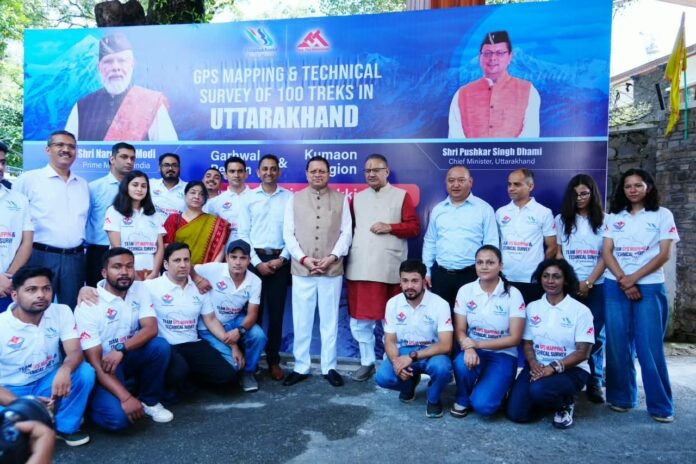
Dehradun: Uttarakhand is set to become the first state in the country to carry out scientific GPS/GIS-based digital mapping of its major trekking routes. Chief Minister Pushkar Singh Dhami flagged off the GPS/GIS mapping teams of the Uttarakhand Tourism Development Board (UTDB), which will conduct scientific GPS mapping and technical surveys of 100 major trekking routes across the state.
Under this ambitious initiative, trek routes spanning nearly 5,000 to 10,000 kilometres are to be mapped using scientific GPS/GIS technology. Officials have described this large-scale digital and scientific mapping as a historic achievement for Uttarakhand’s trekking tourism sector, calling its scale unprecedented compared to any effort undertaken in the country so far. The teams dispatched include GPS specialists, GIS specialists, trekking experts, trek leaders, content writers and app developers. In the first phase, the teams will cover 35 trek routes, with special focus on high-altitude routes above 5,000 metres, so that surveys can be completed before snowfall begins in November.
Speaking on the occasion, Chief Minister Pushkar Singh Dhami said Uttarakhand has always been known for adventure and trekking tourism, and that for the first time in the country, the state is writing a new chapter by linking its trekking routes with modern technology. He said the initiative is in line with Prime Minister Narendra Modi’s vision of a “Viksit Bharat 2047” and will establish Uttarakhand as a technologically advanced, safe and sustainable trekking destination. The Chief Minister called it a new direction for the state’s adventure tourism sector, adding that the initiative would further strengthen Uttarakhand’s image among trekkers from India and abroad.
Tourism Secretary Dheeraj Singh Garbyal said this is the first project of its kind in the country, being developed with the cooperation of the Forest Department, Uttarakhand. He said the database created under the project will provide accurate information on trek routes, campsites and toilets among other essential facilities, ensuring feasibility, safety and sustainable management of trekking. He added that the detailed digital database prepared under the project will play an important role in bringing the state’s entire trekking network onto a single integrated digital platform, which will also aid policy-making and resource management.
A key feature of the project is the online and offline GPS navigation app being developed alongside it. Notably, the app will also function in “no-network zones” with no internet connectivity. If a trekker strays from the designated path, the app will automatically reroute them back onto the correct trail, significantly improving trekker safety in remote and difficult terrain and enabling more precise direction for rescue operations during emergencies.
Through detailed GPS/GIS mapping of the selected trekking routes, the state’s extensive trekking network will be given a digital form. During the mapping process, key details of the trek routes — their actual length, elevation, major halting points, camping sites, water sources, toilets and other available facilities — will be systematically recorded. This will also help bring recognition to remote and relatively lesser-known trekking destinations that have so far remained off the digital tourism map.
According to the Uttarakhand Tourism Development Board, the initiative will prove to be a milestone in promoting safe, responsible, accessible and technology-driven trekking tourism in the state. The Board believes it will give fresh momentum to scientific documentation of the state’s trekking network, better management, tourist safety and digital promotion of remote tourist destinations. Officials said the mapping of the remaining routes will be completed in phases in the coming months, positioning Uttarakhand as a model state in trekking tourism.